
Land Analysis & Ecological Design
Work With the Patterns of Your Landscape
We use Geographic Information Systems (GIS) and ecological analysis to reveal how water, terrain, and climate interact—so your decisions work with the land, not against it.
Let the Land Show You What to Do
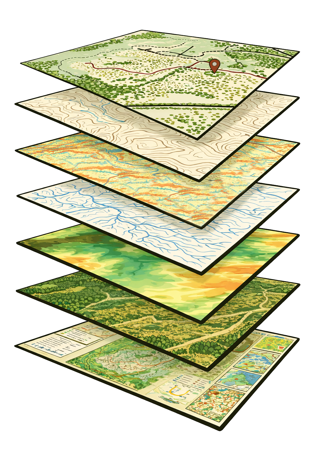
By layering terrain, water, and environmental data, we establish a reliable foundation for site planning and implementation.
Layered Site Analysis
Where water naturally moves and collects
Areas prone to erosion or instability
Optimal locations for access and infrastructure
High-leverage intervention points
Zones suited for planting, habitat, or restoration
Supporting professionals, organizations, and land stewards working with complex landscapes.
Who Benefits From This Work

Ecological Design & Landscape Architecture Firms
Turn site analysis into clearer concepts, stronger proposals, and more grounded designs.

Environmental Organizations & Land Trusts
Understand landscape systems to guide restoration, conservation, and funding decisions.

Restoration & Land Management Contractors
Reduce uncertainty before breaking ground—identify access, drainage, and constraints early.

Municipalities & Planners
Plan infrastructure and land use with a clearer understanding of terrain and water behavior.

Landowners & Regenerative Farms
See how your land works so you can make confident decisions about planting, water, and layout.
Supporting Better Decisions Across:
Risk Reduction
Capital Planning
Design Validation
Site Feasibility
Ecological Performance
Not sure where you fit?
If you’re working with land and need better insight into how it functions, this is for you.
Our In-Field Workflow
How it works
Analyze Maps -Determine points of interest
Add to device - Review data in the field
Use the app - Record pins, photos and tracks
What We Offer
Remote spatial modeling and landscape assessment tailored to your Site
Mapping & Analysis Packages

Site Intelligence
Understand the physical structure of your land before making decisions.
This package reveals terrain, slope, and landscape patterns that influence water flow, access, and overall site constraints.
Watershed and Hydrology
See how water actually moves across your site and beyond it.
Identify drainage patterns, upstream influences, and areas of accumulation to inform water management, restoration, and infrastructure planning.
Microclimates
Identify where conditions shift across your landscape.
This analysis reveals solar exposure, cold air movement, and temperature variation to guide planting, siting, and long-term system performance.
Basemaps
A complete, design-ready foundation for planning and implementation.
Combines key spatial layers into a clear, organized map that supports design, communication, and project execution.
Not sure what you need?
Start with a Site Intelligence Package or reach out for guidance— we’ll help you determine the most useful analysis for your project.
From Maps to Meaningful Decisions
Maps reveal patterns—but understanding how to act on them is where real value emerges.
Our work doesn’t stop at delivering GIS analysis. We help you interpret what the maps are actually telling you about your land—how water moves, where energy concentrates, where risk or opportunity exists—and how those patterns translate into real-world decisions.
Many clients receive high-quality maps but struggle to fully integrate them into planning and implementation. We bridge that gap.
Foundational Site Analysis
The starting point for all mapping and design work—revealing how terrain shapes water, access, and land use decisions.
These analyses reveal the underlying structure of your land. Together, they provide the essential context needed before making decisions about water management, access, or design.
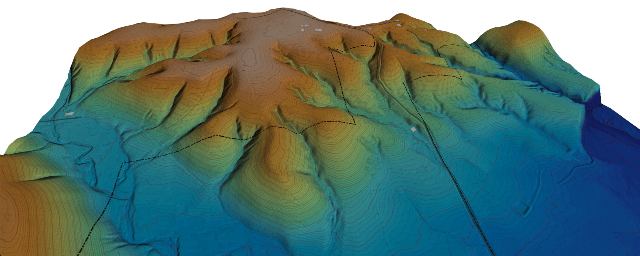
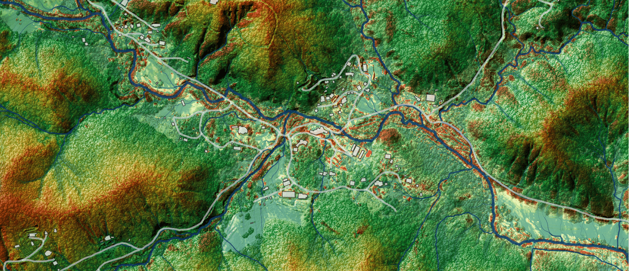
Core Terrain Analysis
Terrain Structure
terrain shape
Elevation + Contours Map
Reveals the shape of the land—ridges, valleys, and elevation changes that influence how water, materials, and energy move across the site.
slope gradient
Slope Map
Shows how steep or gradual different areas are, helping identify where access is feasible, where erosion risk increases, and where systems can be placed effectively.
slope direction
Aspect Map
Indicates which direction slopes face, shaping sunlight exposure, temperature, and moisture—key factors for planting and microclimate design.
These foundational analyses are required for all advanced mapping and design work
Surface Conditions & Derived Patterns
terrain visualization
Hillshade Map
Provides a shaded relief view of the terrain, making landforms easier to interpret. It reveals subtle features—such as old roads, drainage paths, and legacy disturbances—that are often difficult to see in raw elevation data.
water accumulation
Wetness Map
Estimates where water is likely to accumulate, persist, or drain across the landscape based on terrain and flow patterns. This helps identify wet zones, saturation areas, and drought-prone ridges to inform water management and planting strategy.
terrain variability
Ruggedness Map
Measures how smooth or complex the landscape is, highlighting areas of stability versus highly irregular terrain. This helps inform access difficulty, infrastructure placement, and areas where ecological complexity may already be high.
These derived layers build on the foundational site analysis, providing deeper insight into how the landscape functions
Water Systems analysis
Understanding how water moves across the landscape—from watershed-scale patterns to site-specific flow and flood dynamics.
Water is the primary force shaping the landscape.
This analysis reveals how it enters, moves through, accumulates, and exits your site—providing the foundation for water management, restoration, and resilient design.
Multi-Scale Hydrological Analysis
landscape context
Watershed Modeling
Places your site within its broader hydrological system, showing how water flows from the surrounding landscape and influences conditions on-site.
flow organization
Drainage Network & Basins
Maps how water organizes across the landscape—revealing flow paths, drainage boundaries, and how water concentrates and moves through the site.
flood & microtopography
Flood & Channel Modeling
Highlights subtle elevation differences relative to drainageways, revealing flood-prone areas, terraces, and zones suitable for infrastructure or planting.
These hydrological analyses build on terrain analysis to reveal how water behaves across scales, informing design decisions that work with, rather than against, natural systems.
Microclimate & Solar Analysis
Understanding how sunlight, temperature, and terrain interact to shape growing conditions and long-term system performance.
Microclimate patterns determine where systems thrive—or struggle.
This analysis reveals how terrain influences sunlight, heat, moisture, and cold air movement across your site, helping guide placement, planting, and long-term resilience.
Energy & Temperature Patterns
flow acceleration & accumulation
Curvature Map
Identifies where the landscape sheds or collects water, soil, and organic matter by distinguishing convex (shedding) and concave (accumulating) areas.
temperature movement
Cold air pooling
Reveals where cold, dense air settles across the landscape—highlighting frost-prone zones and warmer elevated areas.
solar energy distribution
Incoming Solar Radiation
Shows how sunlight is distributed across the landscape over time, identifying areas of high exposure, shade, and seasonal variability.
These microclimate analyses build on terrain and hydrology to reveal how energy moves across the landscape
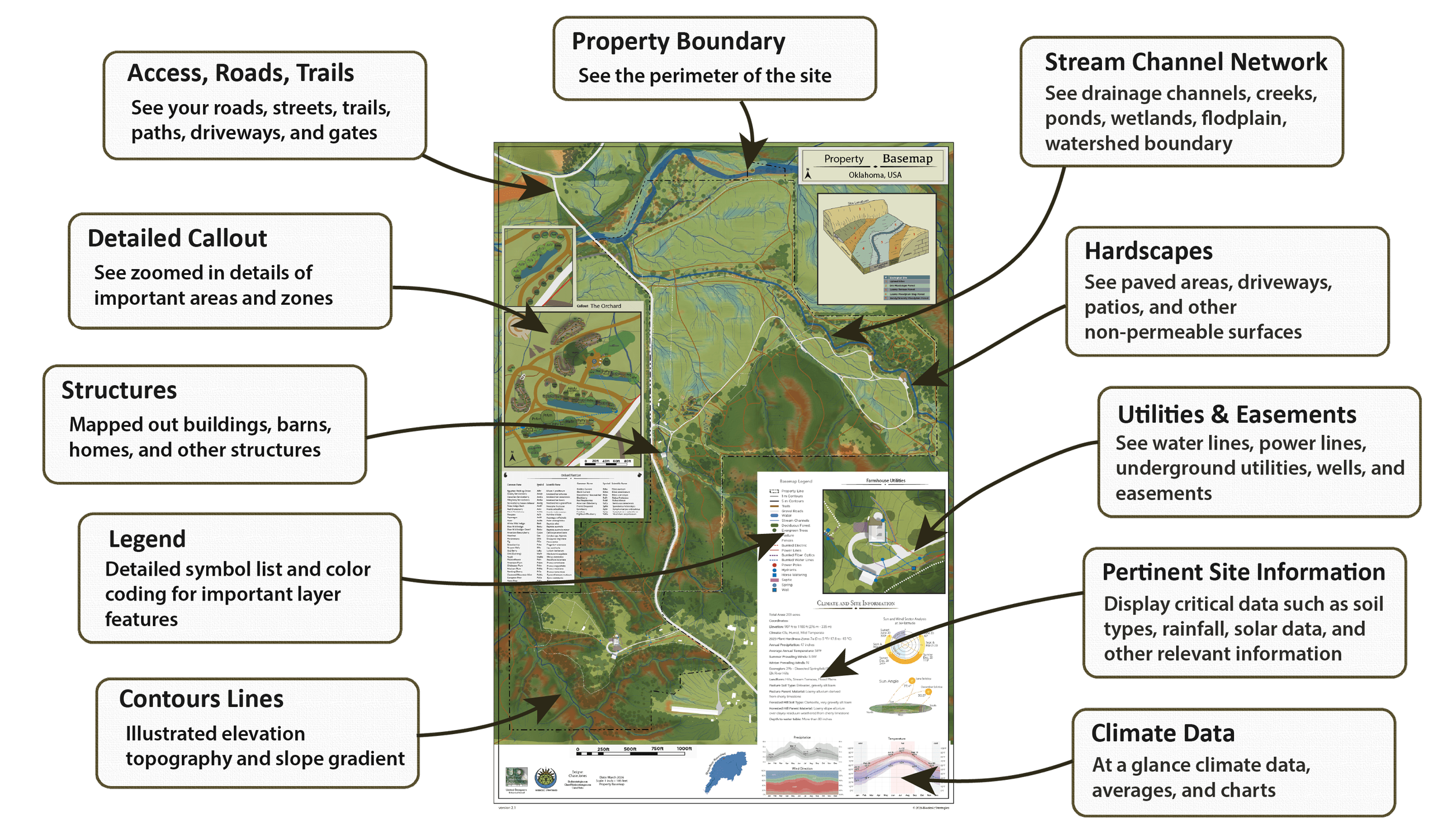
Integrated Basemap
A complete, design-ready representation of your site—bringing together terrain, water, infrastructure, and key spatial data into one clear reference.
The basemap is where all analysis comes together.
This is the working document used to plan, communicate, and implement your project—keeping every decision grounded in real site conditions.
Elements of an Integrated Basemap
Gain a detailed understanding of your land with a basemap that incorporates all critical elements of ecology and infrastructure to inform regenerative design
Design-Ready Site Map

Alabama Basemap
A mid-sized rural property with mixed terrain and drainage complexity, requiring integrated water and access planning.
Key Features:
• Contours & hydrology
• Access & infrastructure
• Landcover & boundaries

Massachusetts Basemap
Annual Precipitation: 61 inches
Elevation: 190m-464m (623 ft-1522 ft)
Total Area: 342 acres
Climate: Dfb - Warm-Summer Humid Continental
Ecoregion: Berkshire Transition
2023 Plant Hardiness Zone: 6a (-10 to -5 °F)

Arkansas Basemap
A larger, forested landscape with varied elevation and watershed influences across the site.
Key Features:
• Terrain variation
• Watershed context
• Vegetation patterns
Each basemap serves as a central reference point—allowing design decisions to stay grounded in the realities of the land.
Field-ready mapping and implementation
Design is only valuable if it translates to the land.
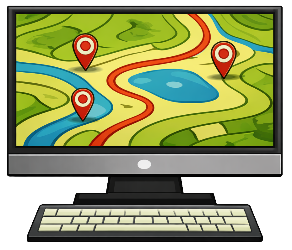
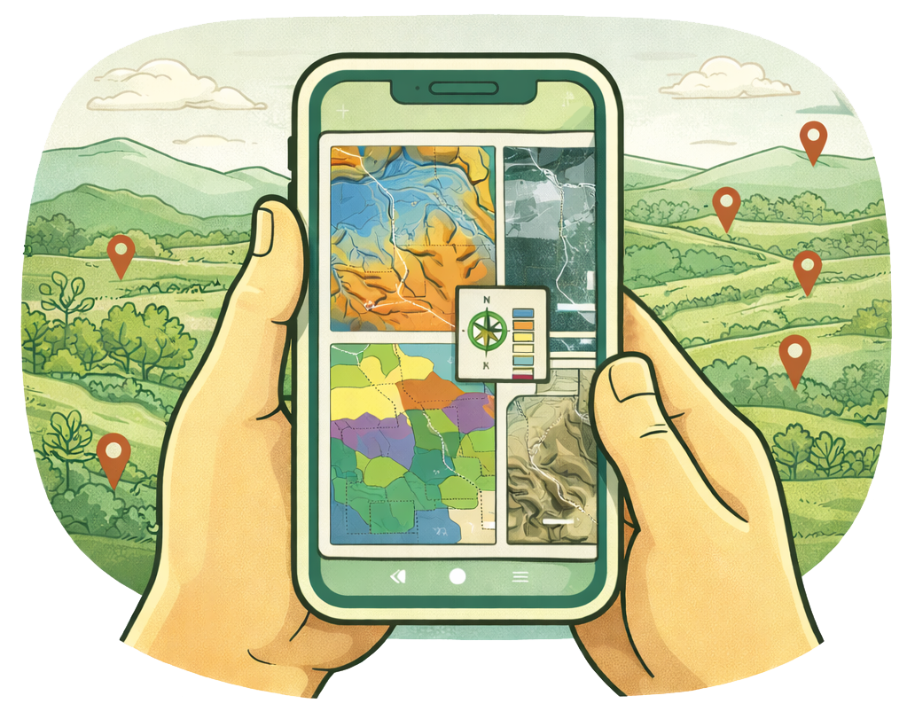
We provide georeferenced maps that integrate with your mobile device, allowing you to navigate your property with your design in real time. Whether you’re locating a future pond site, laying out a planting zone, or assessing terrain in the field, these maps provide spatial clarity and confidence.
This workflow bridges the gap between analysis and action—ensuring that what is designed can be accurately implemented, adapted, and understood on the ground.
Using Maps to See More on the Ground
These maps are not a replacement for on-site observation—they’re a tool to deepen it. They provide landscape-scale awareness that helps you see patterns more clearly while walking the land.
The most effective approach is to move between map and landscape—using each to inform the other.
walk the land with the map
Explore in 3D (Google Earth)
View your site in 3D to understand terrain, elevation, and large-scale patterns that are difficult to perceive from the ground alone.
zoom out to see the whole system
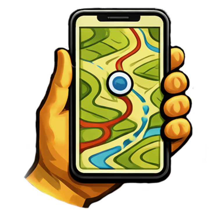
Field Navigation (Mobile Maps)
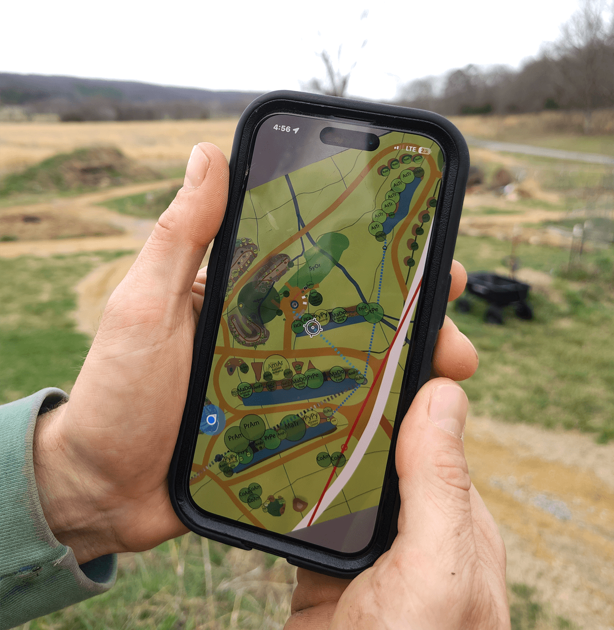
Use your maps directly in the field to compare what you see on the ground with mapped patterns—revealing relationships that are easy to miss otherwise.
shared understanding
Printed Basemaps
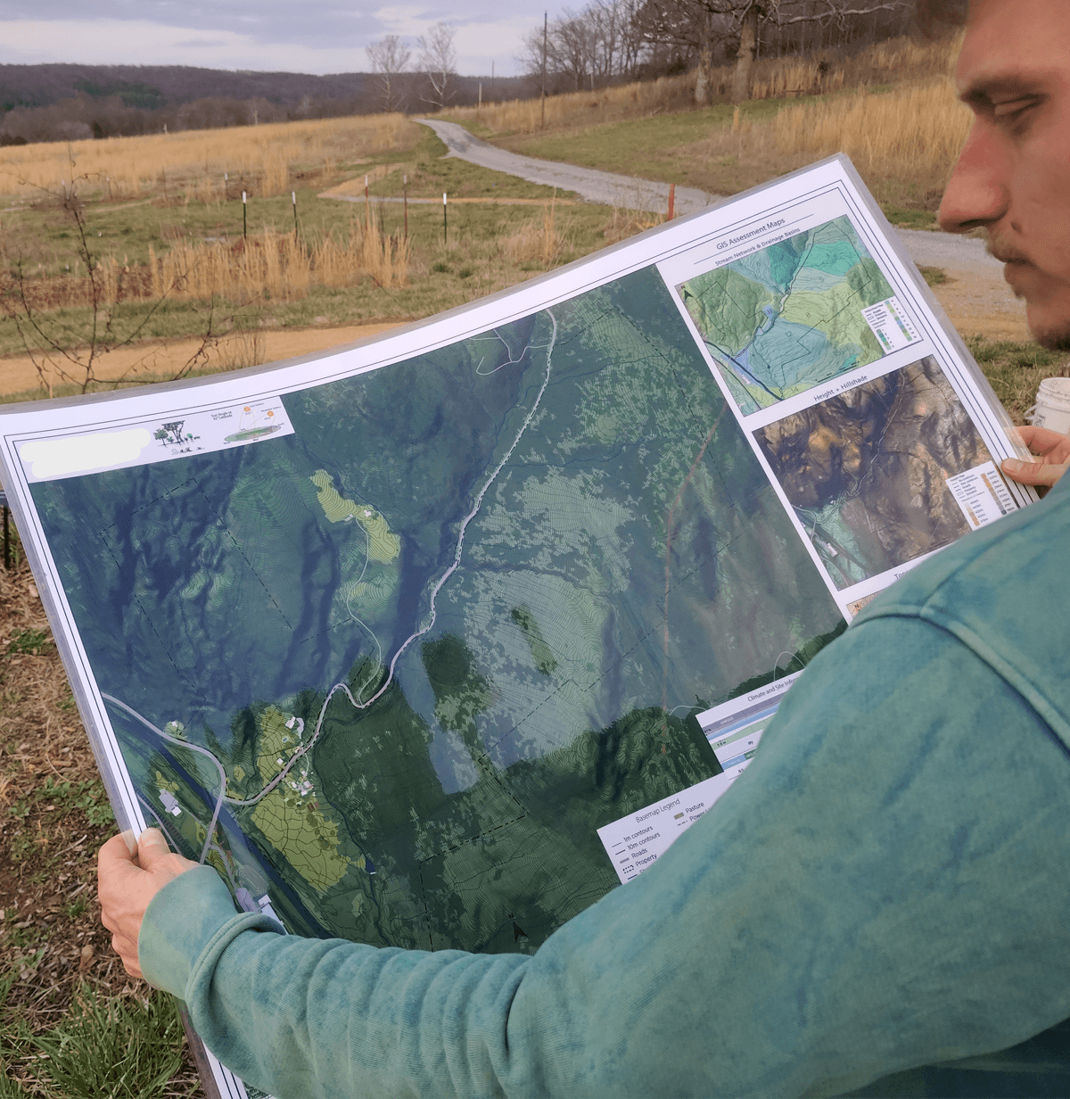
Large, high-resolution prints create a shared reference point—ideal for walking through plans, collaborating with others, and grounding discussions in the reality of the land.
The goal is not to replace observation, but to sharpen it—helping you see more, understand more, and make better decisions on the ground.
Our georeferenced maps work seamlessly with your smart device to bring your maps into the field during site walks, stakeholder meetings, and on-site planning sessions